Showing posts with label urbanism. Show all posts

Wednesday, 7 September 2011

An Urban Sublime


In his book The Art of Travel Alain de Botton describes the "sublime" as those things which display a great power, a power greater than that of humans. The word is intended to be used to describe things which emphasise the smallness of humanity in comparison to the power and wonder of nature. Most commonly this meant heroic landscapes such as mountains, gorges, deserts etc.

I've been fortunate enough to have my own experience of the sublime, most strongly when I was being driven through the Norwegian fjords, weaving around gigantic barren snow-capped mountains. Unlike the rolling pastures of England, it is a landscape which seems brutally indifferent to human existence.


Being in the metropolis has also aroused a similar feeling in me. Although this strays from the above definition of the sublime by describing an experience of something human-made, I believe the feeling can be just as powerful. An example from my own experience is my encounter with Manhattan. Wandering among the giant buildings, their size beyond the immediate comprehension of a pedestrian I felt enclosed by mountains. At other times the views down the streets brought to mind endless canyons. Immediately I felt small and insignificant compared to phenomenon that is New York City. It wasn't an unpleasant feeling but an awe inspiring and humbling one.

Mountains

Canyons

Other examples could include the experience of being in Sao Paolo or Hong Kong.

 Forest


 Gorge

Do these settings arouse the sublime only because they remind us of natural phenomena which could more readily be described as such? I believe that's part of it. But I also believe that such experiences of extreme urbanity place us in a situation where we face the reality of incomprehensible human abundance and are our place in it. Society suddenly feels very big and we can feel very small.

Among the skyscrapers and heaving masses we feel insignificant, but I would also say that we feel liberated knowing that our own worries and problems are just a small number among millions of others. Although own particular problems may seem personal to us, chances are, out there, many others have gone, are going or will go through the same.


Although it may not be quite the same as the natural sublime, the urban sublime has its own atttraction and is worthy of our attention.

Sunday, 7 March 2010

Streets and post-streets: Hong Kong's contrasting urban forms

Hong Kong, due to its geography and its particular political and economic development, is one the most densely populated cities in the world. This density is evident in the glittering skyscrapers and endless concrete apartment blocks forming the backdrop to every tourist's holiday snaps.

One would think that such density would result in a uniform urban form, one that pragmatically acquiesced to the demands of thousands of people living on top of each other. On the surface this seems true: as any visitor would attest, almost all of Hong Kong can be typified by huddled buildings, crowded footpaths and congested roads. However further examination reveals that even in this forest of skyscrapers there are varying urban forms which respond differently to the demands of extreme density. This variety can be best understood by looking at two areas of the city which, in terms of urban form, are polar opposites to which all other areas can be placed between. These two areas are Central (and surrounds), on Hong Kong Island itself and Mong Kok, on the Kowloon Peninsula.

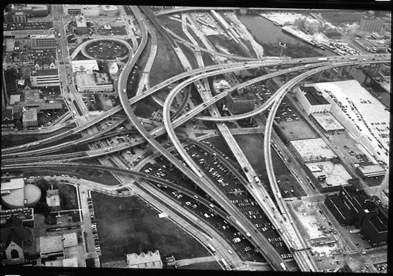
The area made up of Central, the Mid-Levels and Soho (which I'll just call Central) is an infrastructure playground. Snaking between the soaring skyscrapers is a maze-like network of pedestrian over- and under passes which themselves weave around a network of motorway flyovers. On Hong Kong island, the response to the congestion problem has been to layer the transport network so that volume is spread vertically, minimising conflict between transport modes. This response can be attributed partly to the island's topography. From the harbour, there is only a small area of flat land before there is a dramatic slope upward to the peak of the island. This sloping topography means that ground level for one building is third floor level to another one downhill. This relationship meant that it made sense to build walkways directly between buildings rather than relying on the steep and undulating street network for circulation. The tendency for redevelopment on Hong Kong island to occur in large chunks also meant that it was easier to plan for these connections as architects and developers had control of large holdings of land. It would be much more difficult to connect many smaller disparate buildings all owned and built at different times.

Overpasses in Central

Pedestrian and vehicle traffic are separated onto their dedication channels

Another overpass

The outcome of this multi-layered pattern of development is an urban form which has transcended the traditional street. Getting from building A to building B in Central is often a matter of navigating pedestrian overpasses and tunnels, hopping from one shopping mall to the next, often without setting foot on a street. In fact, one loses the sense of where ground level is. A train station may be connected to a basement shopping centre which may connect to the second floor of a nearby office block which connects to an overpass to a residential complex etc.

In Central it is almost possible to experience the city without the street, one might say that it is has become post-street. A obvious manifestation of this idea is the Mid-Levels escalator. which connects low-lying Central with the Mid-Levels residential district further uphill. Built at several metres above ground level, the escalator is designed to avoid the winding and narrow streets below. It is an open admission of the limits of the traditional street network in an area of extreme density and difficult topography.

The Mid-levels escalator

In Mong Kok however, the traditional street network is all there is. The streets are laid out in a simple grid on which many old and dilapidated buildings sit. The buildings are on much smaller lots resulting in a fine-grained urban form contrasting with the big block development on Hong Kong Island. What this means is that almost every building relies on the traditional street frontage for access. There are very few connections between buildings which avoid the street thus creating a situation where almost all pedestrian circulation must occur at street level. In a place which is said to be the most densely populated on earth, this means extreme levels of pedestrian congestion. Mong Kok is nuts.

Street level Mong Kok

Buildings on small lots results in an urban environment with a "fine grain"

A Mong Kok street in the early morning

Despite the congestion, it is actually easier to understand Mong Kok as a pedestrian. To use the jargon, it is easier to read because it is more legible. Getting from building A to building B is conceptually simpler: you walk out the front of one place, walk along the street, then walk through the front of the next place. Places are connected by streets. You don't have to use an overpass which becomes an underpass which becomes a shopping mall which becomes another shopping mall. Instead, getting around Mong Kok involves you being inside, then walking outside then going back inside. "Ground level" is still a useful concept.

In my opinion, this reliance on the street results in a more vibrant and vital urban experience. The overhead walkways and tunnels of Central seem cold and sterile in comparison. They are designed only to get hoards of people from one place to another. Although the streets of Mong Kok perform this function as well, they are mostly un-programmed public spaces, blank canvasses on which a variety of social interactions can occur. This is why the best street markets are in Mong Kok and why street dining is such an exciting and memorable experience.

Temple Street night market as seen by a streetside dining table.

This is not to say that Central doesn't have its charms, it is a vibrant place in its own way, but Central and Mong Kok represent two differing extremes of the Hong Kong urban experience. This differentiation is a result of the ways in which pedestrian and vehicle traffic is managed. Mong Kok is reliant on conventional intersecting streets on which pedestrians and vehicles must negotiate each other. Although this approach may struggle to cope with the high volumes of traffic involved, it encourages interaction and creates an exciting urban experience. While in Central, although the street is still fundamental, it has been augmented by more specialised networks which take pedestrians and vehicles off the street and onto overpasses and motorways. This dispersal of traffic away from the traditional street means that the the very idea of the street no longer figures so heavily in the urban experience as it does elsewhere.

Who needs the street?

As more large scale redevelopment reaches Mong Kok (see Langham Place, for instance), it will be interesting to see if the same approach is taken to managing circulation. One hopes that if this is the case, it will not be at the expense of Mong Kok's vibrant streets.

Tuesday, 9 February 2010

Concrete streets


With timber being an expensive import in a country of palm trees and steel and brick also prohibitively expensive for most of the populace, concrete has become the de facto building material for the Philippines. From Mega Manila to the smallest farm shack, concrete is used for anything which requires some permanence in this typhoon prone nation. Bus stops, road signs and even statues of historic figures are rendered in concrete. But it is in the construction of ordinary buildings which reveals the pragmatic relationship that Filipinos have with concrete.

Almost every building in your average Filipino city or town is constructed from concrete, usually in the form of prefabricated blocks supported by a reinforced concrete frame. These block walls are then rendered but often money is tight and it is not unusual to see them left as is.


Despite this economical pragmatism, there is evidence of aspirational optimism too. Buildings are often built with future extension in mind. Concrete frames are erected and filled in but the ends and edges are left completely exposed - even after the building is occupied. Steel reinforcement wires jut upwards and outwards in anticipation of when finances allow the family the extra bedroom or the landlord the extra storey.


This honest approach to constructing a living environment results in an urban landscape which openly admits its propensity for change. These buildings are not close-ended set pieces intended to remain unchanged forever (like most buildings in the developed world), they are literally open-ended components of a constantly changing and adapting habitat system.

Tuesday, 27 October 2009

Planning Permission Refusal Haiku

The Development Control system, like all bureaucratic systems, operates in an often dry and impenetrable language which serves only to highlight the self-importance of the system itself. When one receives a letter stating that planning permission is refused and the reasons are given using such overwrought and obtuse phrases like "adversely affecting adjoining residential amenity", "obtrusive visual bulk and oppressiveness" and "harmful discordance in the public realm", one is led to hopeless despair.

To prevent this, I propose that reasons for refusal be given in haiku format to inspire zen-like consideration of one's town planning transgressions, thus leading to better quality planning applications and avoiding needless self-harm.

Here's some I prepared earlier.


Modern design in

Conservation Area

Is not in keeping


Such rear projection,

Due to loss of light, will harm

Their amenity


Parking provision-

Amount is contrary to

Council policy


The scheme’s density:

It’s outside the range set out

In the London Plan


The proposed flats have

Inadequate floorspace.

Not acceptable.


Application form

Was completed in a way

That is incorrect


No space for a car

Travel options are few.

Need cycle parking

Tuesday, 29 September 2009

High speed rail for the USA - Part 2


Following on from my previous post about the proposal to create a high-speed rail network in the US, I inevitably wondered whether it’s too little too late to really to make an impact on the American transport network. But what would it take to really change something, to alter the course of transport development? Ridiculous amounts of rail investment and a regime of petro-fascist car burning? Wouldn’t that be fun?

But looking back, where could the course of history be changed to bring about a more efficient and urban America in the present day? Here I indulge in some bad alt-history transport fiction…


…whoosh. Her dreadlocks swayed gently as the air around her shifted in response to her sudden materialisation in the halls of Congress. Time-travel was a mostly quiet affair but the sound of air displacing was impossible to avoid. The sound always put her on edge. What if someone heard? What if I materialise in a wall? These fears entered her mind when that gentle sound, much like the sound heard when flapping a bed sheet, signalled the end of a jump. Her fears dissipated as she realised the building was empty and dark. No one was around. She was safe.

It was the early hours of June 29 1956. The time traveller had arrived on date and on location. Wasting no time she expertly made her way through the warren of offices and backrooms until she came upon an impressive pile of papers. It was the Federal Aid Highway Act 1956, bound and ready to be signed by President Eisenhower and made law. Here sat the legislation that would bring into being the largest public works project in the world and define the fundamental character of regional transport in the US. Pausing only momentarily for reflection, the time traveler quickly switched the papers for another set: similar in size, similar in appearance, your average government clerk would not tell the difference. But this set of papers would forever alter the course of America’s urban history for across the top, where one would find the words Federal Aid Highway Act 1956, four crucial letters were substituted for four others. Standing there, beholding the papers, the time traveller's eyes repeatedly scanned these four letters as her mind tried to comprehend the implications that her actions would have for many years to come.

A noise in the corridor broke her concentration. Who could it be? There is supposed to be no one here at this hour. There was no time to worry. She flicked a switch attached to her wrist and moved to a clear space in the centre of the room. A very faint, very high pitched whine emanated from her wrist. She was about to jump. It was her cue to close her eyes and count backwards from three. Somewhere a door creaked open. Was she seen? It doesn’t matter…3…2…1…whoosh. She was gone, leaving no trace of her existence save for a pile of papers titled “The Federal Aid Railway Act 1956”.


How would this badly written piece of transport nerd fan fiction continue? What would have happened if the 25 billion dollars earmarked for an interstate system was spent on trains and tracks instead?

It could be argued that the interstate highway system is a key factor in encouraging America’s default settlement model of suburban sprawl. Yes encouragement came from elsewhere too, particularly biased mortgage lenders, tax incentives from local government and ingrained aspirations for “The American Dream”, but the interstate highway provided the infrastructure for single-family houses to spread quickly and easily across the countryside. It provided a lattice for mass produced suburbs to hang on. Without it, new suburbs would have had to locate closer to existing transport networks instead of latching onto newly available channels between larger cities.


So what would have happened if they built a fast efficient rail network in place of a highway system? As I said in my previous post, a rail network differs to a highway network in that its points of entry are fewer and different in nature. You have to go to a station to use it. There is also a mode change to rail meaning that you must abandon whatever mode of transport you previously used. These two factors encourage people to settle closer to stations. It saves time and reduces the need to undertake a cumbersome mode switch (car to rail or bus to rail instead of just walking). And in situations where rail outclasses the car in terms of access to employment centres (as it does in older more urban cities and as it would in our hypothetical rail-America), the attractiveness of driving a car to work falls dramatically. So what we get is a shift away from car transport as the default means of commuting. This is the case in archetypical urban centres like New York City and London, large cities which did most of their growing before the automobile age. By nipping the interstate highway in the bud and focusing on rail, it may have been possible to continue this model of urban transport.


Urban growth would follow a pattern of concentrated settlement centred on train stations and these would spread outwards from existing centres. There would be no need to push for Transit Oriented Development as it would be a common-sense notion from the start (like it is in much of continental Europe). Also urban decay which has beset the downtown of many rust belt cities would be avoided as the attractiveness of the urban centre would remain.

Our rail-America would be compact, efficient and less oil dependent. Would there be cultural implications as well? Would railways figure highly on the American consciousness? In our alternate universe General Motors is General Rail and Detroit becomes known as the Locomotive City (LocoMotown?); songs are written romanticising the open railways, Route 66 is Line 66; mediocre comedians ask “what’s the deal with train food?” to bemused audiences. I’m firmly in the realms of facetious speculation here, but it is interesting to wonder just how far reaching the implications would be if America’s transport history was substantially altered.


Wednesday, 9 September 2009

High speed rail for the USA

A month or so ago Mr Obama has pledged US$13bn for high-speed rail in America and Ray LaHood, Obama’s transport secretary has been zipping around Europe on a fact finding and tendering mission trying to get some speedy trains stateside. For me, this is major shift in federal transport policy is one of more immediately interesting impacts of Obama’s presence in the White House.


This image from Infranet Lab shows that the proposed routes for high-speed rail will be between the major centres of America’s conurbations. Good stuff. However rail is expensive and politically dicey on the ground as new tracks and noisy trains are likely to bring out staunch NIMBYism. It could be said America is already culturally biased for the car and against trains and other collective modes of transport so ploughing new rail lines through commuter suburbs is not likely to make you many friends at the mall. A rather ridiculous and hilarious article in the LA Times (via BLDGBLOG) betrays the distrust toward rail transport that might be held by many Americans (In some European cities Muslims live near train stations so therefore rail transport = TERRORISM). So whether this scheme gets off the ground (on track?) despite the mountain of cash behind is the question. Notwithstanding my stereotyped view of American transport attitudes, implementing some sort of national rail project when the last train tracks in the America were probably laid by slaves and indentured Chinese workers is an important step towards a more sustainable transport system.

What would the implications of high-speed be for the urban form? It is likely that high-speed rail will initially be implemented along already densely developed rail-served corridors as a means of improving existing services. That great smudge of concrete in the north-east running from Boston to Washington DC (“Bo-Wash” among cool urbanists) comes to mind. The implications here won’t be that amazing. Fast efficient travel between existing urban nodes will just shift some mode-share to rail (which is good!) but these cities are already relatively rail oriented and there will just be a slight intensification use around the new stations, if any.

What would be more interesting is the sudden appearance of high-speed rail in the sun-belt regions like California and the South where cities grew up on a diet of cars and cul-de-sacs for most of their lives. If the Americans follow the successful Spanish model of brand new dedicated lines (rather than upgrading existing lines like the French) then perhaps we’ll see sleek high-speed trains cutting through the endless sprawl with surgical precision. How will the urban morphology respond to this sudden addition of a fast point-to-point transport mode in an environment of diffuse and de-centred car travel?

A new high-speed system is likely to connect existing urban cores with other important cores while serving a few regional centres along the way. New stations will instigate new higher density development, both residential and commercial, to take advantage of expanded employment and consumer markets. There will be a lot of park-and-ride facilities but the sudden concentration of people will no doubt bring more properly urban development. Existing centres will be made more resilient and perform better as places of exchange. There may even be a bunch of mini-Lilles springing up. Lille, that peculiar place you stop on your way to Paris on the Eurostar, has become a sort of virtual centre for the high number of very important people living in London, Paris and Brussels who are less than a hour’s train ride away. As a result, Lille has gained a lot more importance and success as a city than its modest size suggests.

Obviously, the impact will be on a much smaller scale and there is still the tide of continuing suburban sprawl to contend with but the insertion of a transport system which by nature shores up urban centres rather than bleed them dry is a good start in steering America’s urban development to more resilient ends.

So will we see soulless business hotels and conference centres springing up along zippy train lines across the US? Let’s hope so. It will be more sustainable and drunken conventioneers wouldn’t have to worry about being caught for DUI on the way home.